Description of the Seaports of the Kingdom of Portugal
Description of the Seaports of the Kingdom of Portugal
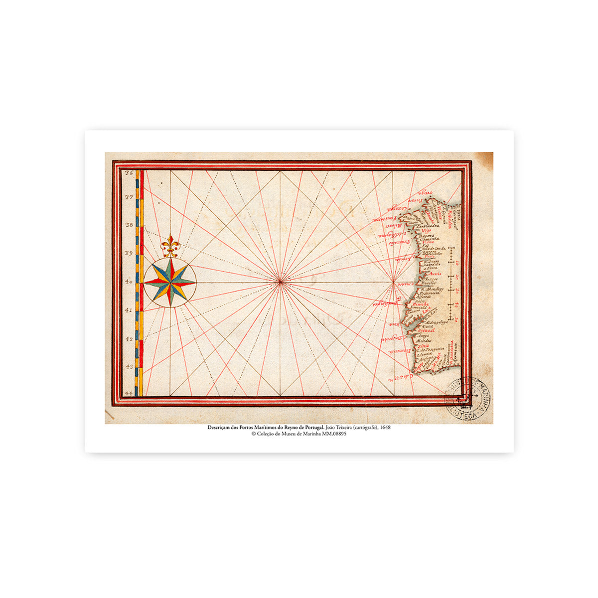
Reproduction of the Map "Description of the Maritime Ports of the Kingdom of Portugal", whose original was executed in 1648 by João Teixeira, His Majesty's Cosmographer. A historical document of rare beauty belonging to the Museu de Marinha Collection, now available in an exclusive art edition.
Drawn during a crucial period in national history — right after the Restoration of Independence — this map presents a detailed survey of the coast and strategic ports of the mainland territory. The piece stands out in the collection for its artistic and technical components, displaying an imposing illuminated compass rose and the dense network of rhumb lines (loxodrome lines) that guided navigators along the "Kingdom of Portugal".
Giclée print on White Velvet archival cotton-based paper (270g).
Dimensions: 40 x 30 cm
Origin:
Original Title: DESCRIPÇAM DOS PORTOS MARÍTIMOSDO REYNO DE PORTVGAL.
Author: João Teixeira (Cosmographer of His Majesty, Anno 1648).
Inventory No.: MM.08895
Origin: Portugal.
© Museu de Marinha Collection
Couldn't load pickup availability
Partilhar