Trindade Island
Trindade Island
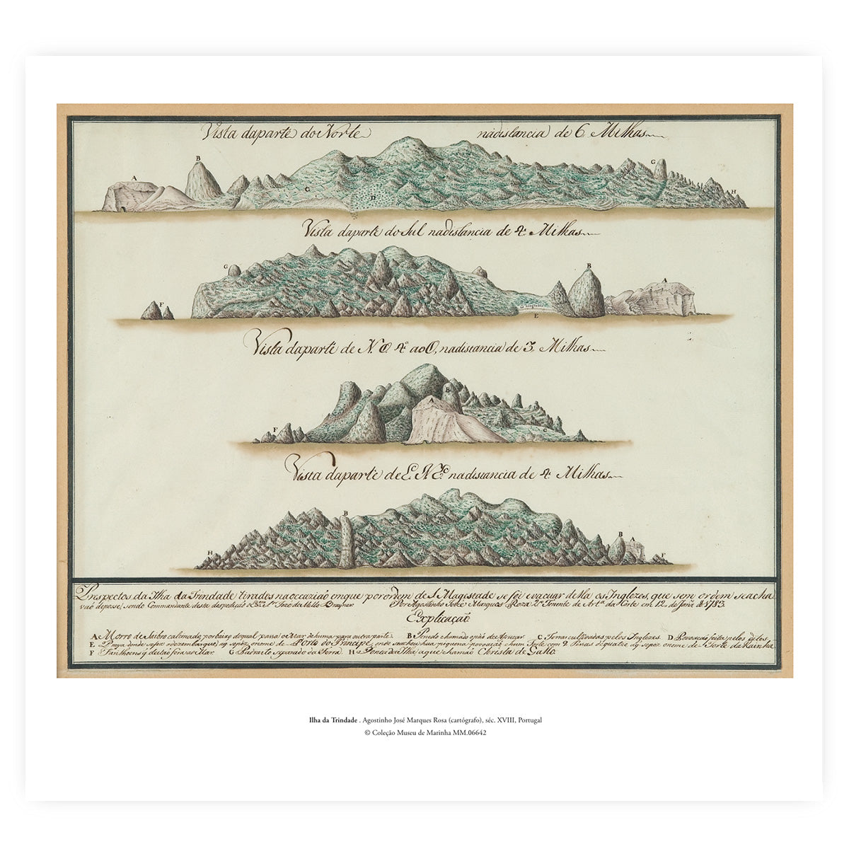
Cartographic reproduction of Trindade Island (a relevant insular territory in the South Atlantic, on the route to Brazil), the 18th-century original of which belongs to the collection of the Maritime Museum.
This work reproduces the historical map authored by the Portuguese cartographer Agostinho José Marques Rosa, drawn in the 18th century.
Giclée print on White Velvet archival paper (270g) with a cotton base
Dimensions: 53.5 x 50 cm
Original:
Inventory no.: MM.06642
Origin: Portugal
Theme/Subject: Cartography; Brazil
Caption: Between 1781 and 1783, Trindade Island was occupied by the English. In 1783, a squadron commanded by José de Mello Breyner sailed to the island to monitor the evacuation of the island by the English. On that occasion, these three maps were drawn.
© Maritime Museum Collection
Couldn't load pickup availability
Partilhar