Art Print St. Helena Island
Art Print St. Helena Island
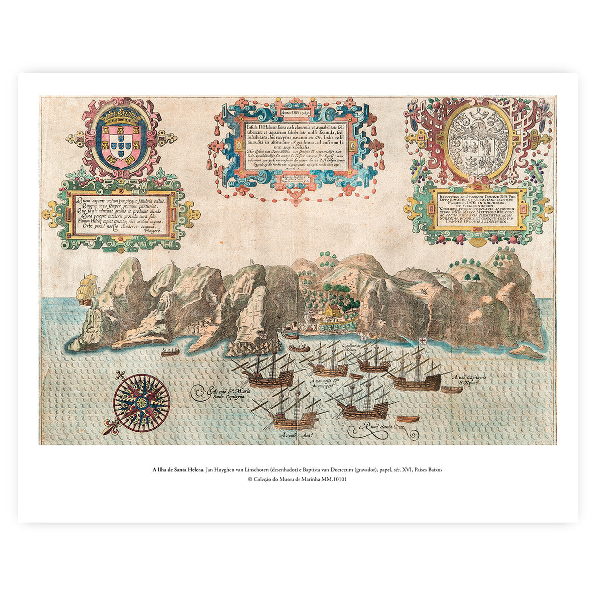
Reproduction of the map "The Island of Saint Helena", one of the most strategic and fascinating cartographic records from the late 16th century. The original drawing was executed by the celebrated Dutch chronicler and traveller Jan Huyghen van Linschoten and immortalised by the prestigious engraver Baptista van Doetecum. A documentary gem belonging to the Museum of Marine Collection, now available in a magnificent art edition.
The Island of Saint Helena, located in the heart of the South Atlantic Ocean, played an absolutely crucial role as a stopover, resupply, and refuge point for Portuguese and European fleets returning from the India Run. This 16th-century map, originating from the Netherlands, meticulously captures the island's topography, its bays, and the local fauna and flora, serving as a unique glimpse into the maritime cartography of the Age of Discoveries.
Giclée print on White Velvet (270g) cotton-based archival paper.
Dimensions: 50 x 40 cm
Original:
Title: The Island of Saint Helena.
Drawn by: Jan Huyghen van Linschoten.
Engraved by: Baptista van Doetecum.
Collection Inventory No.: MM.10101
Origin: Netherlands
Date: 16th Century
© Museum of Marine Collection
Couldn't load pickup availability
Partilhar